
There wasn’t a specific address, just a crossroads.
A good 20 minutes out of town, the intersection of Sears and Wright Station roads is definitely somewhere in the middle of nowhere. The hills were looking dry and not so green, even after the rain of recent months.
Signage reads: “TRESPASSING LOITERING FORBIDDEN BY LAW SAN JOSE WATER COMPANY” and “NO TRESPASSING TAMPERING WITH THIS PUBLIC WATER SYSTEM IS A FEDERAL CRIME.” This gate was propped open. Onward.
Messaging introduced the Los Gatos Creek Watershed Collaboration Forest Health Project, in partnership with Cal Fire, Santa Clara County FireSafe Council, San Jose Water, Midpeninsula Regional Open Space District, Santa Clara County Parks, California Climate Investments, ASCENT and Forestry and Fuels ARC Resource Management.
All these organizations, and more, are collaborating to reduce wildfire risks and protect our watershed. And on Friday, the Los Gatan got a glimpse of the high-tech way they’re doing it, as part of a public tour. Anna Eshoo, of California’s 16th Congressional District, sent a representative, as did state Senator Dave Cortese. PG&E told organizers it was otherwise occupied.
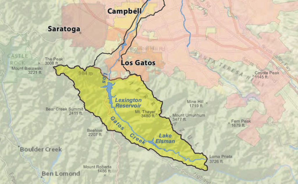
A watershed is the area that collects rain, snow and other runoff into a single body of water. During a forest fire, great harm can be done to it—and (if we rely on it for what comes out of our taps) to our drinking supply. Lake Elsman is a critical H2O resource, supplying about 100,000 people. On Friday, it had water flowing over the spillway. The plan was to walk up to it, around 11am, to see the new helicopter and meet its crew.
Cal Fire has the largest firefighting force in the nation and the largest civil aerial firefighting fleet in the world. The State agency has been replacing its existing helicopter fleet of Super Huey helicopters with 12 Sikorsky S70i Blackhawks. This Los Gatos-based copter is equipped with night vision, meaning it can be operated around the clock.
Cal Fire considers the 650,000 acres of Santa Cruz Mountains watershed surrounding the Alma base as “high value,” and it has continued to foster partnerships to reduce the risk of wildfire, including with the Santa Clara County FireSafe Council.
“Everyone has some skin in this game,” said Seth Schalet, CEO of the Santa Clara County FireSafe Council. “If you want to reduce wildfires, everyone’s got to get involved.”
He went on to explain how “artificial intelligence” is being used to detect fires here.
The water officials, firefighters and volunteers have turned to N5 Sensors’ N5SHIELD™ array. “It has been in use here for about six months—San Jose Water now has 15,” he said, adding it can source its own solar power, run off batteries or get power from the grid.
The N5SHIELD uses multimodal sensors and AI processing to provide accurate real-time alerts when a fire ignites, attendees heard. The idea is to have technology help first responders analyze weather conditions and assist with figuring out how to manage firefighting resources in the initial minutes of a fire.
San Jose Water Environmental Planning and Natural Resources Manager Jared Lewis says the sensor network is an important component of the corporation’s overall wildfire mitigation strategy. “Early detection of wildfire on SJW watershed lands is critical to ensuring clean and reliable water supply for Santa Clara County residents,” he said. “Through our partnership with the Santa Clara County FireSafe Council, we are excited to spearhead the first phase of this network covering ~6,000 acres of watershed land with N5Shield. Over time, through collaboration with future partners, we anticipate covering over 100,000 acres with a network of sensor solutions.”
In addition to adopting new strategies to pinpoint fires at their inception, there are other tactics being used prior to wildfires starting that may slow down a fire, so it doesn’t become extremely dangerous. This involves removing nonnative plants, dead trees, underbrush and leaf litter. Prescribed burns, of the sort Cal Fire is conducting this week next to the Henry Cowell Redwood State Park campsites, are another tool.
The Los Gatos Creek Watershed Collaboration has brought together many players for firefighting and land stewardship to work toward the goal of creating a healthy forest. And when there is a wildfire, they want to be ready to contain it as swiftly as humanly possible—or quicker, with the help of AI.
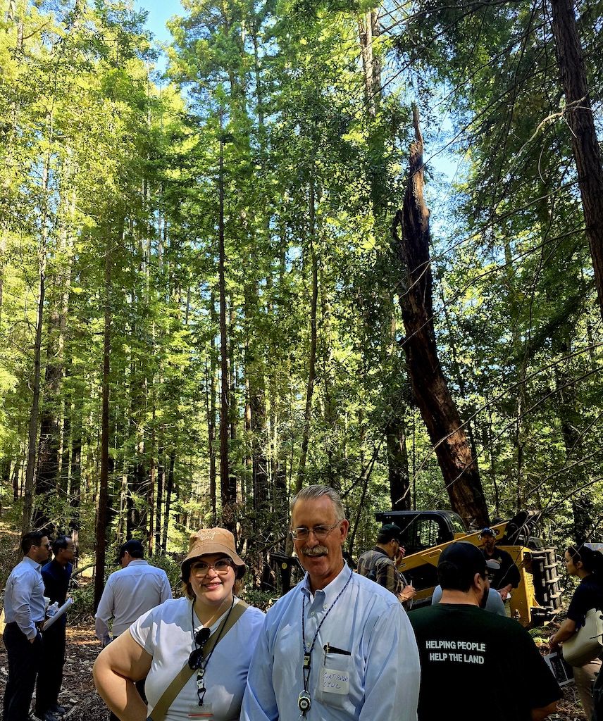
Other groups, including a representative of clothing-optional resort Lupin Lodge, which served as a staging ground during a previous wildfire, spoke of their organizational duties and commitment to work together. After that, our group of around 25 people headed out for the walking tour.
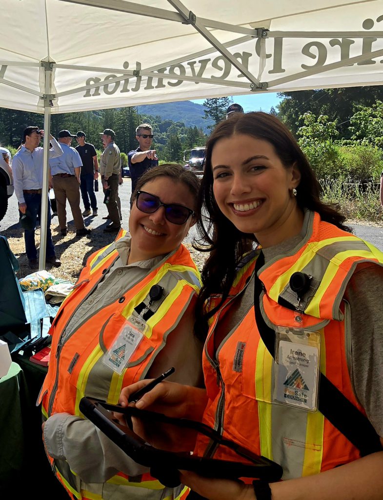
We were led by Irene Armstrong and Tara Wallichs, of the FireSafe Council, to a burn scar area. Stephen Harrington, a project manager with the organization, pointed to trees bearing scorch marks. “A lot of that was from the fuel load,” he said. “This is what we are trying to avoid. This was from the 1985 Lexington Fire, a 13,000-acre fire that burned 42 homes, and was caused again by stray fireworks…The last one we had that affected the watershed was the Loma fire in 2016—that burned 4,478 acres.”
Harrington described how containment lines used in previous fires, including Lexington, were also used to fight the Loma Fire. “A lot of these strategic field breaks that we are trying to enhance are not just picked out on the map,” he said. “There are reasons why we do that. Again, all of these fires were man-made. None of them were natural ignitions.” But, he says, natural forest fires—which happen every 5-25 years—aren’t necessarily a bad thing. “What we are doing is breaking up the continuity of the watershed to mimic what a low-intensity fire would do in this watershed, without using the fire,” he said. Translation: hazardous fuel reduction.
Steve Auten, a forester with ARC forestry, spoke next about how to select areas of the watershed to focus on defending. He said this can include monitoring prevailing winds and figuring out how to deploy firefighting equipment during emergencies.
After our time in the burn scar, we all headed up to Lake Elsman to see the helicopter. We had heard it circling overhead and were looking forward to meeting the three-person crew. However, we’d already been warned that these folks were on active duty, meaning on call should fire break out somewhere. Eventually, we learned it had, indeed, departed to battle a fire in Contra Costa County.
Sign up online for reverse 911 alerts here: sccfiresafe.org/resources/reverse-911/


")

